The City of Calaca
Profile
| Total Land Area | 114.58 square kilometers |
| Number of Barangays | 40 |
| Urban | 6 |
| Rural | 34 |
| Population | |
|---|---|
| Total Population as of 2020 Census | 87,361 |
| Basic Facilities | |
|---|---|
| Hospitals | 1 |
| Clinics | 5 |
| Lying-in | 1 |
| Market (public) | 1 |
| Postal Service | 1 |
| Recreational Facilities | Multi-Purpose Gymnasium |
| Calaca Track and Field Oval | |
| Calaca Auditorium | |
| Transportation | Land & Sea |
| Power Supply | Batangas Electric Cooperative(BATELEC I) |
| Water Source/s | Level 1, 2 & 3 |
| Educational Institutions | |
|---|---|
| City College | 1 |
| Technical and Vocational Schools | 1 |
| High School | 7 Public/4 Private |
| Senior High School | 1 Public/1 Private |
| Elementary | 31 Public/4 Private |
| Telco Provider | |
|---|---|
| Cellular Phones | Globe, Smart, PLDT, Sun cell and Dito |
| Landline | Globe, Converge, Continental |
ECONOMIC DATA:
A first-class City that generates its income from various sectors.The major economic activities in Calaca include Agriculture, Service Manufacturing, Tourism, Cottage Industries, and Mining.
| Annual Income | |
|---|---|
| Income Class: | 1st Class |
| Income Sources | |
| - Internal | 553,901,151.57 |
| - External (NTA) | 337,625,663.15 |
| Total Annual Income | 891,526,814.72 |
Major Economic Activities
- Power Generation
- Service Manufacturing
- Tourism
- Agriculture
- Mining
- Cottage Industries
List of Locators
- Balayan Distillery, Inc.
- Asian Chemical Corporation
- High Street Manufacturing Inc.
- Steel Asia Manufacturing Corporation
- Phoenix Petroleum Phils. Inc.
- Calaca Industrial Seaport Corp.
- Arvin International Marketing
- Pozzolanic Philippines, Inc.
- Semirara Mining and Power Corporation
- Southbank Bulk Terminal, Inc.
- Holcim Phils. Mfg. Corp.
- Sem-Calaca Power Corporation
- Balayan Bay Batangas Development Inc.
- South Luzon Thermal Energy Corporation
- South Pacific, Inc.
- D.M. Consunji, Inc. Steel Fabrication
- Philippine Prosperity Chemicals, Inc.
- Calaca Bay Terminal Incorporated
- Atlantic Grains Inc.
- Calaca Harvest Terminal Inc.
- Knauf Gypsum Philippines, Inc.
- MCMAI (Cebu) Trading Corporation
- Phoenix Asphalt Phils., Inc.
- Southwest Luzon Power Generation Corporation
- Rezcoat, Inc.
- Batangas 1 Electric Cooperative, Inc.
The City of Calaca
History
Founding Year
How Calaca Got Its Name
There are two versions on how the town of Calaca got its name. The first is about the story of ten Datus who escaped Borneo and reached the islands of Panay. Every hunt when they see fellow tribesmen, they always exchanged greetings such as “Kalaka” and “Katribu”, meaning fellow tribesmen. The greetings to each other remained and eventually became the official name of Calaca.
The second version is about a story of Spaniards who passed by a group of native people building a nipa hut. The Spaniards asked for the name of the area of the natives, but the latter could not understand their language, they assumed that the Spaniards asked about what they were doing. So they answered, “Kalaka”, because they were installing the roof made out of “laka” a bamboo split into two laid upside down cover the edges of the halves. This resulted to how Calaca got its name.
Establishment of the Town
Rufino Punungbayan, Cayetano Buhay, Januario Punungbayan, Valentin Capacia, Juan Sanggalang, and Diego Inumerable pioneered the establishment of the Town. Don Rufino Punungbayan was the first Gobernadorcillo of the Municipality from 1835-1836.
Calaca is on the eastern portion of the present Poblacion, just on the other side of the Bolbok River. Houses in the municipality were built with “Kalaka” roofing. Over time, the barrio grew and thrived. However, the founders were worried about its location, considering the topography of the surrounding vicinity – it was sandwiched closely by the two ravines on both the east and west sides. Hence, they looked for a better site. The present site – a wide plain – was finally selected to be the site of the Poblacion. Roads were laid out as they are now but were not given names. One road at the back of the present church disappeared because no one cared to pass there.
It was in the latter part of the Spanish regime and the early part of the American military rule that the streets were named, mostly in honor of those who contributed to and worked hard for the welfare of the town.
Years later, Filipinos were hired to teach. One of them was Manuel Agregado, appointed as a teacher in 1905 and later became Auditor-general of the Philippines.
Luckily enough, the Second World War spared Calaca from considerable destruction. The first Japanese soldiers arrived in Calaca in the middle of January 1942. Several months later, they commandeered tillable lands and planted cotton around September 1942. This led to the establishment of the Dai Nippon Bosok KK company which succeeded the Tokatu Cotton Company, an earlier establishment.
Around December 30, 1941, USAFFE soldiers were deployed in different parts of the town. The 41st infantry division was strategically stationed in Dela Paz St. along the western portion of the bank of the Bolbok River. A foxhole was dug extending up north to Maugat from the corner of the old Highway, which is now part of Rodriguez St. It strategically positioned 50 caliber machine guns in the occupied area.
The 41st Infantry division left the municipality on December 21, 1941, for Bataan. Soon after the fall of Bataan on April 9, 1942, the underground movement was organized in Calaca. Many of the Calaqueños joined the organization. Secret meetings were held in houses in the Poblacion to map out plans against the Japanese Imperial Forces.
The guerillas of Calaca helped a lot in the expeditious liberation of the town from the Japanese forces. They cleverly managed the detection of Japanese activities and spied on their positions, trenches, dugouts, strength, food supply and ammunition. The Japanese occupation in Calaca lasted from February 1942 until March 6, 1945, when the American Liberation Forces, along with some guerilla units, entered the town. The war did not cause much destruction to the lives and property of the people in Calaca. Most of those who died were soldiers who fought in Bataan and war prisoners who did not survive the Death March.
Shortly after the establishment of the military government in the archipelago several months after the liberation, Calaca was included in the list of beneficiaries under the Philippine Relief and Rehabilitation Administration.
However, several years later, fear reigned once more in the hearts of the natives. During the height of the campaign of the government against dissidents in the central plain of Luzon, the Hukbong Bayan Laban sa Hapon movement spread as far as the most remote barrios of Calaca. It came to a point when the barrio folk took up arms and fought the Hukbalahap (or Huks).
One by one, they surrendered to the government forces which, in turn, willingly granted them amnesty. Those who remained with the movement were considered outlaws and were later killed in action or liquidated by their companions in consideration of a modest sum offered by the government. Hence, the Huk movement in Calaca was suppressed.
The Quest for Cityhood
On July 11, 2017, Former Mayor Sofronio Manuel C. Ona together with the Members of the Sangguniang Bayan submitted a letter to the Office of Honorable Eileen Ermita-Buhain, Congresswoman of the First District of Batangas, requesting for the elevation of the Municipality of Calaca into a component city.
On March 11, 2020, Mayor Sofronio Leonardo “Nas” C. Ona, Jr. attended the House Committee on Local Government hearing in line with the proposed cityhood of the Municipality of Calaca. Subsequently, the House of Representatives passed House Bill 6598 enacting the Cityhood of Calaca, and forwarded it to the Senate.
On October 26, 2020, a virtual Senate Committee Hearing on Local Government was attended by Mayor Nas Ona which led to the passage of the first reading on December 16, 2020, and the second reading on February 3, 2021.
It was a significant moment for every Calaqueño when the Cityhood of Calaca was passed by the Senate of the Philippines on the third and final reading on February 8, 2021.
Another milestone was inked in the history of the humble town of Calaca when President Rodrigo Roa Duterte signed Republic Act 11544, An Act Converting the Municipality of Calaca in the Province of Batangas Into a Component City to Be Known as the City of Calaca.
The Ratification of the City of Calaca
On September 3, 2022, the City of Calaca was finally ratified as a component city by a plebiscite held among the majority of its citizens under the administration of Mayor Sofronio Leonardo “Nas” C. Ona Jr.
The City of Calaca
Demography
HISTORICAL GROWTH OF POPULATION/POPULATION TREND
The 2020 population of Calaca is higher by 5,502 than the population of 81,859 in 2015, and 16,840 more than the population of 70,521 in 2010. Moreover, it is higher by 28,872 compared with the population of 58,489 in 2000. The population of Calaca increased by 1.38 percent annually from 2015 to 2020 (2020 Census Press).
The increase in population can be attributed to the higher number of births than the number of deaths in a year. There are 20 live births per 1000 population in a year while there is only an estimated average ratio of 3 deaths per 1000 population in a year.
The increase in population can be attributed as well to the presence of major industries which could have provided employment opportunities for locals as well as migrants to the city.
URBAN AND RURAL HOUSEHOLD POPULATION
The population residing in urban Barangays is classified by the NSO as urban population, while the population in rural Barangays is classified as rural population.
Out of 40 Barangays, the Poblacion area (Barangays 1-6) is considered as the urban Barangay. The total urban household population is 5,656. The Poblacion is the most densely populated area with an average of 32 persons per hectare. Being the center, the Poblacion consists of several institutions like schools, churches, marketplace, a police and fire department, and a city hall.
The remaining 34 Barangays are classified as rural Barangays with a total population of 81,705. Among the rural Barangays, the most densely populated are those along the highway, coastal area, and near the Poblacion area. It is considered the central business district of the municipality.
These Barangays have easier access to transportation facilities, major institutions, industries, and services.
The least populated rural Barangays are those that are in hard-to-reach areas. These are Barangays in upland areas, where the upslope level ranges from 18-30% to more than 50%. They have easy access to transportation lines, and they are far from the CBD.
URBANIZATION/DISTRIBUTION
Urbanization refers to the concentration of human populations into discrete areas. This concentration leads to the transformation of land for residential, commercial industrial and transportation purposes.
The current urbanization level of Calaca is 9%, while the rural area urbanization is 91%, which is expected to go into faster urbanization due to its recent cityhood status.
Built-up density indicates the concentration of population in built-up areas. It is a gauge of how dense certain built-up areas in an area have become.
The gross urban density shows the concentration of the total urban population over the total area of identified urban barangays. The computed urban density is 31 persons per hectare as compared to the rural density of 5 persons per hectare. This means that rural areas are less populated than urban areas. The gross density is 5 persons per hectare. Calaca is considered a low-density area since its computed built-up density is 69 persons per hectare.
AGE & SEX STRUCTURE
The population distribution by age indicates a high distribution in the age bracket of 15-64, which is the productive or working age. They constitute the potential labor force of the city and economic activities which are labor-intensive and income-generating activities should be given greater emphasis to meet the needs of the labor force as well as the dependent population at 61% and 35% are in the age bracket of 14 and below. Only 4% of the population is above 65 years old.
The sex ratio is 99.6 males, which is less than 100. Thus, indicating a predominance of the female population, 49.9% are male while 50.1% are female.
Fertility in the area is high, which accounts for the high young dependency ratio of 57.2%. The old dependency ratio is 6.36%. The total dependency ratio is 63.5%.
MIGRATION AND ITS MEASURES
The population was described to be predominantly Batangueño or original settlers or have been residing for more than 20 years in the city. A low migration turn-off from other areas was estimated at 14%.
MARITAL STATUS
Over 59% of the population are single while an estimated 30% are presently married. A small percentage of the population is either widowed or separated.
RELIGIOUS AFFILIATION OF THE POPULATION
The population is predominantly Roman Catholic with a significant number of other affiliations like Protestants, Seventh-day Adventists, Born Again, Iglesia ni Cristo and Baptist.
EDUCATION
The City of Calaca maintains 33 primary, 11 secondary and 1 tertiary school.
SCHOOL-GOING AGE POPULATION
The majority of the school-going population age enters primary school education (90%), while the secondary school-age population enters school at (70%) and only a lower than 2% of the school-age population is enrolled in tertiary education. On the other hand, the primary teacher population was estimated at 237, while secondary school teachers are 97 and only 9 teachers were in the sole tertiary school in Calaca. The dropout rate for the last three years indicates a decreasing trend at the primary level. The secondary level however showed an increase in dropout rate from 4.22% (1996-97) to 4.66%.
EDUCATIONAL STATUS
The educational status of the population of the City of Calaca presents a highly literate population. Being able to enter the primary and reached postgraduate education. Previous data shows that 7.35% (4269) of the population are college graduates, while 3.84% (2,230) are college undergraduates, 18.79% (10914) have finished high school education while 14.06% (8,167) are elementary graduates 10.88% or 5,855 were reported to be not going in school, while only 2.74% have no education at all. The local government should provide non-formal education in the city, which will cater to the out-of-school youth.
The average student-classroom ratio is 33:1 for the elementary level and 56:1 for the secondary level. The average student-teacher ratio is 31:1 for the elementary level and 40:1 for the secondary level.
The City of Calaca
Geography
GEOGRAPHY
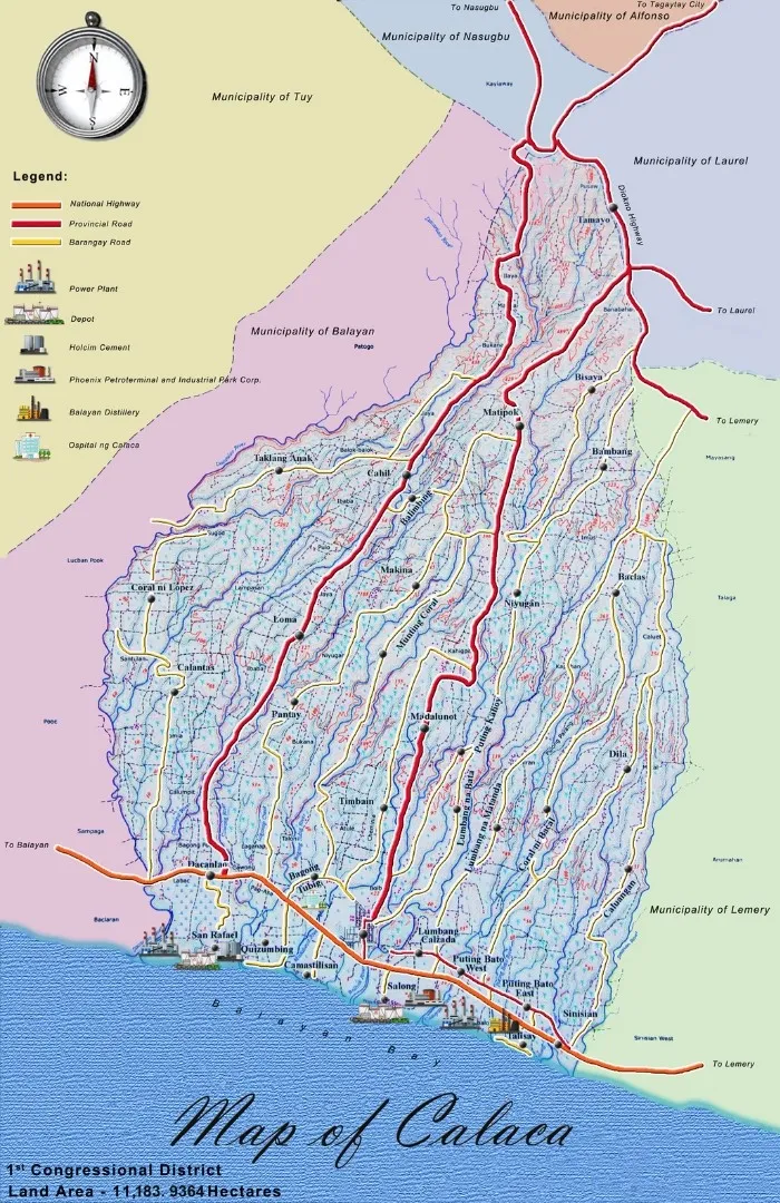
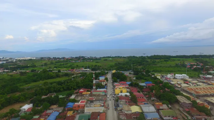
The City of Calaca, Batangas is located at 13° 56` latitude and 120° 49` longitude at the southwestern mouth of Luzon Island along the western part of Batangas Province. It is situated east of the municipalities of Balayan, Tuy, and Nasugbu, west of the municipalities of Lemery and Laurel, and north of Balayan Bay. It lies within the southwest slopes of Talisay.
City of Calaca is a coastal town, bound by Balayan Bay in the south. It is a plain near the shore, gently rolling in the middle and going steep on the northernmost to Gulod ng Batulao.
GEOLOGY AND GEOMORPHOLOGY
City of Calaca has a total land area of 11,064.03 hectares. Tephra deposits of calderas, maars, tuff rings, and cones including large-scale surge deposits led to the formation of Calaca. This process is called volcanism, which was caused by the formation of the Taal Volcano Calderas some 140,000 years ago. Mt. Batulao located at the northwestern tip of Calaca then was a volcano and acted as a barrier in such a way that it blocked pyroclastic materials coming from erupting Taal Volcano.
Pyroclastic materials are ejecta consisting of unconsolidated materials of different sizes that are explosively or aerially deposited from volcanic vents. The upland portion of Calaca came from pyroclastic materials due to continuous base surges from a series of volcanic eruptions of Taal Volcano.
The low land area is classified as volcanic tuff that was formed mainly due to ash fall and continued lahar flow. Volcanic tuffs are ejected from the Taal volcano and formed underwater resulting in consolidation.
The coastal area came from weathered materials due to rain and sedimentation, thus giving birth to alluvial soil. Alluvial soil consists of fluviatile segments of unsorted and unconsolidated clay, silt, sand, and gravel reworked pyroclastic and volcanic rock segments. (PHIVOLCS)
It can be concluded that the upland area of Calaca is composed mostly of igneous materials and the lowland area of sediment origin is carried in the coastal area by water and wind actions. Base surges from the last eruption of Taal Volcano made the slope of Calaca in the upland area very steep. The areas along river channels as well as their tributaries have steep slopes since the soil is loosely consolidated and easily eroded. Generally, Calaca has a terrain described as highly dissected due to the presence of several sub-parallel streams or barrancas.
TOPOGRAPHY, SLOPE ASPECT AND ELEVATION
The city is divided into three ecosystems. The coastal ecosystem generally has a slope level of 0-3%. The following Barangay fall under this ecosystem: Dacanlao, San Rafael, Quisumbing Camastilisan, Lumbang Calzada, Salong, Talisay, Puting Bato East and Puting Bato West.
The lowland ecosystem generally has a slope level of 3-8%. The Barangays under this ecosystem are Barangays 1-6, Bagong Tubig, Puting Kahoy, Lumbang na Bata, Pantay Madalunot Timbain, Coral ni Lopez, Loma, Portion of Dila, Coral ni Bacal, Lumbang na Matanda and Calantas.
The upland Barangays generally have a slope level of 18% to 50%. These Barangays are Taklang Anak, Balimbing, Matipok, Niyugan, Caluangan, Dila, Munting Coral, Makina, Cahil, Bisaya, Bambang, Baclas and Tamayo.
The Highest elevation in Calaca is in Barangay Cahil with an elevation of 613m above sea level. The terrain of Calaca can be best described as having a gently rolling-deeply-undulating landform and highly divided due to the presence.
SOIL TYPE
Two soil types can be found in Calaca, namely:
Taal loam is in the northern portion of the city covering an area of 7,889.66 hectares. This soil type came from weather materials from pass-based surges of the past eruptions of Taal Volcano. It is generally grayish brown to light gray when dry and dark brown when wet. This type of soil should have limited cultivation and requires very careful land management.
Taal Sandy loam on the other hand can be found in the southern portion of the city and covers an area of 3,381.28 hectares. This soil requires careful land management.
PHYSIOGRAPHY
The Physiography of Calaca is of three types: Escarpment, Broad Alluvial Plains, Volcanic Hills and Mountains. The coastal ecosystem of Calaca is located along the broad alluvial plains. The lowland ecosystem is located mainly along broad alluvial plains while some portions are along volcanic hills. The majority of the upland ecosystem lies along volcanic hills and some belong to the mountain type, Escarpments are present in all three ecosystems except within Barangays 1-6.
PERMEABILITY
Permeability is the property of soil to allow air and water to move into the soil layers.
The coastal ecosystem that is 1 km away from the coastline has moderately slow permeability. This is due to a slope level of 0-3% and its soil type, which is mostly sandy in nature. Water from the uplands is generally retained in this area, therefore, making it flood-prone.
The lowland ecosystem, which has a slope level of 3-8% and a soil type of Taal loam has moderate to moderately rapid permeability.
INFILTRATION
Infiltration is the rate at which water enters the soil under saturated conditions. It is a reliable guide for the frequency and type of irrigation suitable for a given soil type. It gives an idea about the runoff which is directly related to soil erosion.
The coastal ecosystem has a moderately slow to very rapid infiltration rate. The lowland has a slow to moderately slow infiltration rate and the upland ecosystem has a moderate to rapid infiltration rate.
DRAINAGE, TRIBUTARY PATTERNS AND CATCHMENT AREAS
City of Calaca has four major tributary rivers, namely: Dacanlao River, Bolbok River, Bagong Tubig River and Cawong River. Rivers flow from the foothill of Mt. Batulao and drain into Balayan Bay.
MINERALS RESOURCES AND RESERVES
Sand deposits are found along riverbanks. Large-scale quarrying is found in Barangay Dila resulting in sedimentation of the Sinisian River System. Quarrying in Dila is active and abandoned quarry sites were observed. The Sangguniang Bayan approved a municipal ordinance prohibiting such activity along riverbanks, specifically those located near bridges along the national highway.
The City of Calaca
Climate
RAINFALL
Rainfall is the amount of precipitation (expressed in millimeters (mm)) depth of the layer of the water that has fallen.
Climatologically normal gathered from 1961-1995 at Ambulong, Batangas being the nearest station showed that the largest amount of rainfall occurred between May to December, wherein the month of July has the largest amount of rainfall at 335.9 mm.
RELATIVE HUMIDITY
Relative humidity (%) is the ratio of the amount of water vapor in the air to the maximum amount the air can hold at a given temperature.
The average relative humidity in Calaca is 77%. The month of September has the highest recorded relative humidity with 83% while the lowest recorded relative humidity occurred during March with 71%.
TEMPERATURE
Based on Station 432 of the Philippine Atmospheric, Geophysical and Astronomical Services Administration (PAGASA) station at the Ambulong Climatic Station in Tanauan, Batangas; the average minimum temperature in Calaca is recorded at 21.6o C and a maximum temperature of 34.8o C. Annual mean temperature: 27.5o C. Warmest months in City of Calaca are March to May, while wettest months are July to September, when rainfall is almost 3/5 of the annual rains. The coldest months are December and January.
VAPOR PRESSURE
The vapor pressure in Calaca has an annual average of 27.7 millibars (mbs). The month of April recorded the lowest vapor pressure at 27.1 mbs while the highest recorded vapor pressure is during the month of June with 30.0 mbs.
MEAN SEA LEVEL PRESSURE
The mean sea level pressure is the force exerted by the weight of the atmosphere on a unit area at the mean sea level. It is the atmospheric pressure at mean sea level.
The city has an average annual mean sea level pressure is 1,010.1 mbs. The lowest recorded sea level pressure is on the month of August with 1,007.7 mbs and the highest recorded sea level temperature is 1,012.7 mbs, which is recorded during the month of January and February.
PREVAILING WINDS
The direction of the prevailing wind is the most frequently observed during this period, while the average wind speed in the meter per second (mps) is the arithmetic average of the observed wind speed.
The prevailing wind between January and April in the Northeast has a recorded speed of 2 mps. It shifted to Southwest in May to September with a speed of 1 mps; and a speed of 2 mps from July to September. From October to December the prevailing winds returned to the Northeast with a speed of 2 mps. The annual average prevailing wind is northeast with 2 mps wind speed.
Generally, Calaca belongs to Type I climate characterized by having two pronounced seasons: wet, from May to October; and dry, from November to April.
LAND CAPABILITY
The coastal ecosystem has a land capability class of moderate soil condition limitations with shallow profile, low fertility, doughtiness, and slight salinity. Those adjacent to streams and rivers have low to medium fertility, susceptible to seasonal overflow, and have a slight soil condition limitation.
The lowland ecosystem has a land capability class of slight soil condition limitation, with deep soil profile having loamy to clayey soil with none to slight flooding hazard and possible severe erosion in some areas.
The upland ecosystems have moderate soil condition limitation with none to slight flooding hazard severe erosion.
SOIL SUITABILITY
The coastal ecosystem has a moderate to high suitability rating for residential and recreational use. Agriculture is not generally advisable in this ecosystem.
The lowland ecosystem is moderate to highly suitable for residential, recreational, and light industrial purposes. Wet diversified crops, pasture tree crops, and industrial trees are fair to moderately suitable in this area.
The upland ecosystem has moderate to high suitability for residential and recreational use. Barangay Bambang, Bisaya, Tamayo, and Cahil have poor to moderate suitability for residential and recreational uses. All these Barangays, however, have high suitability for forest use.
The City of Calaca
Must See Photos
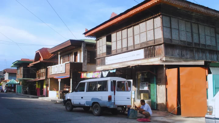
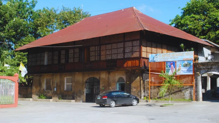
Ancestral Homes
Ancestral homes in Calaca have stood the test of time and remain a testament to the rich culture of Calacazens and the whole Filipino nation.
Its architecture mirrors our colonial past. The ancestral houses are made of wood and are built with traditional windows adorned with capiz shells.
From pieces of furniture that exhibit the craftsmanship and hard work of the hands that made them under their warmth reminding the visitors of the value Filipinos have for close family bonds. These ancestral homes truly root us to our culture and tie us back to our meaningful history.


Atcharang Calaca
Calacazens take pride in their best-tasting Atcharang Calaca. This renowned delicacy may be enjoyed in a variety of ways. It could be made by using either papaya, ampalaya, labong, ubod ng niyog, or seaweeds.
The prime product of Calaca City is served as a pampagana or appetizer and is best paired with savory dishes especially during occasions such as fiesta. It is famous as a gift or pasalubong among friends and relatives whenever they visit Calaca.
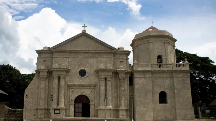
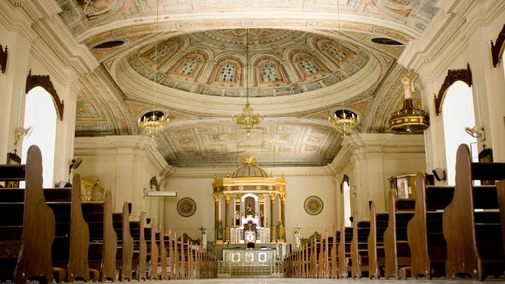
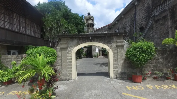
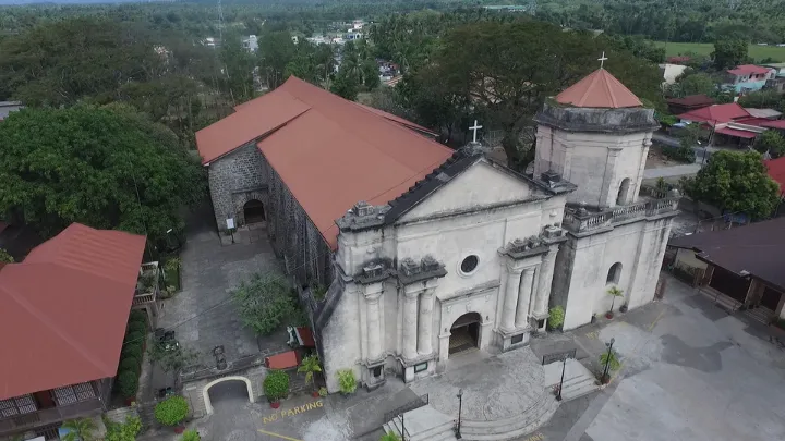
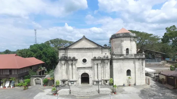
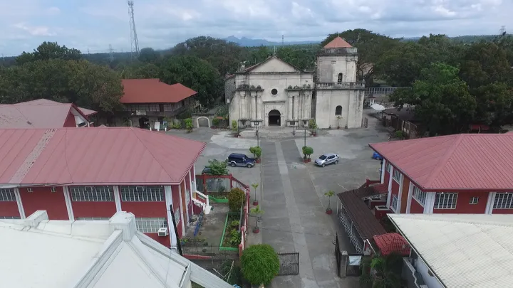
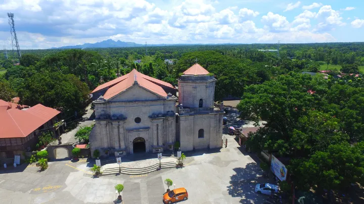
Archdiocesan Shrine and Parish of St. Raphael the Archangel
The Shrine was established in 1836 and has been influential to the growth and development of Calaca.
It has undergone several renovations since it was built, the last major restoration was in 2010 through Architect Susan Castillo with Rev. Fr. Aurelio Oscar B. Dimaapi, former Parish Priest (2010-2015).
St. Raphael the Archangel, who is the patron saint of Calacazens, is known as the patron of the sick, the blind, fishermen, nurses, physicians, and childless couples. Devotees from nearby towns and provinces visit and honor the patron during Holy Wednesday and every 24th of October.
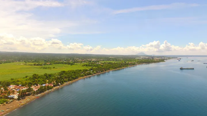
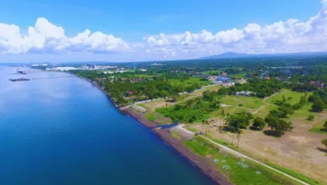
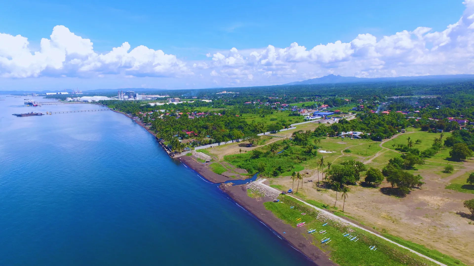
Breathtaking View of the Balayan Bay
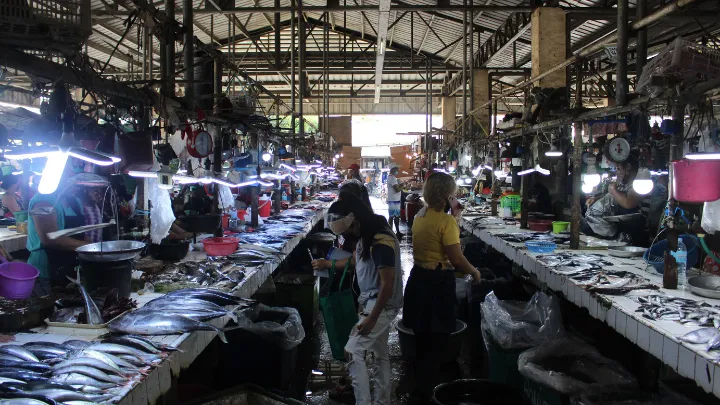
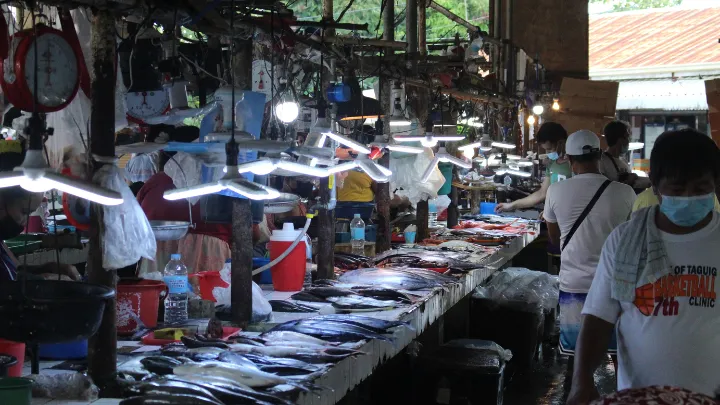
The serene and rich blue waters of the Balayan Bay can be seen from Calaca. Apart from its aesthetic beauty that washes away the worries of every spectator, Balayan Bay provides a good avenue for the continuously booming industries within Calaca.
Resources from this body of water are also put to good use by the Calacazens fisherfolks. Various seafood is sold in the public market and some vendors visit barangays to sell their goods. Moreover, some residents process their catch and sell them as daing or tinapa.
Breathtaking View of the Balayan Bay
The serene and rich blue waters of the Balayan Bay can be seen from Calaca. Apart from its aesthetic beauty that washes away the worries of every spectator, Balayan Bay provides a good avenue for the continuously booming industries within Calaca.
Resources from this body of water are also put to good use by the Calacazens fisherfolks. Various seafood is sold in the public market and some vendors visit barangays to sell their goods. Moreover, some residents process their catch and sell them as daing or tinapa.
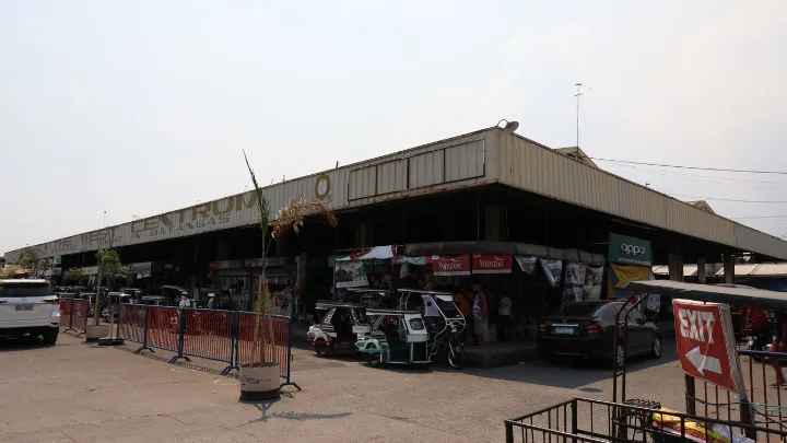
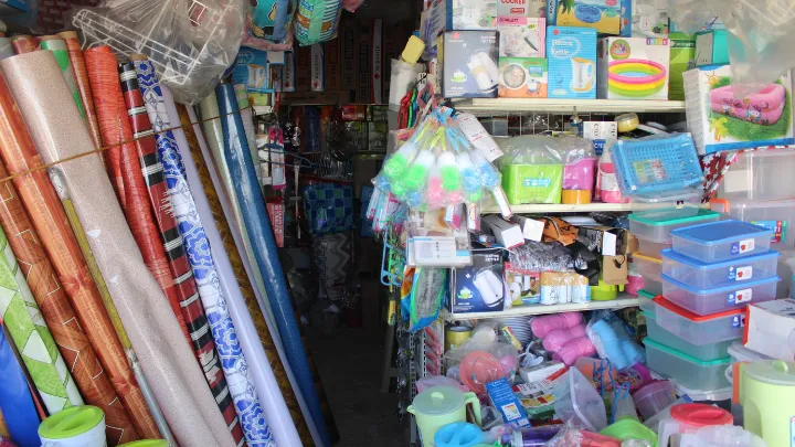
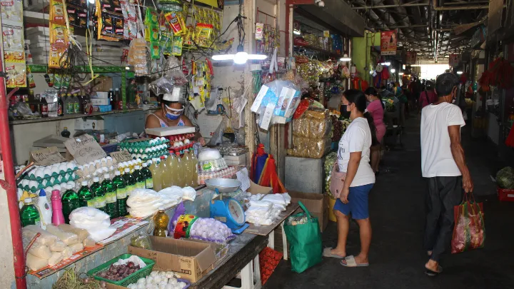
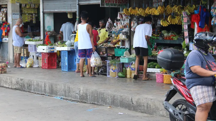
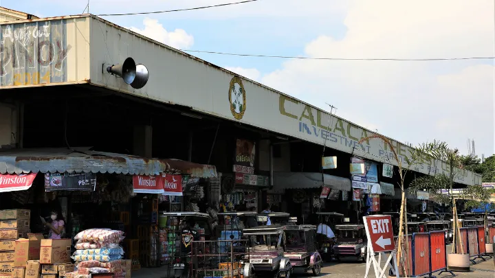
Calaca Public Market
After several phases of construction and rehabilitation, the Calaca Public Market continuously accommodates the needs of every Calacazens. As years passed, stalls around the two main buildings of the public market were erected expanding the services and goods that the locals could avail.
A market is a place that brings people together and gives a glimpse of the history of trade in the community. Every Wednesday, business owners from nearby provinces visit Calaca and put up stalls similar to a tiangge. This is also the same day that residents even from upland areas visit Poblacion as it is a day dedicated to honor their patron saint St. Raphael the Archangel.

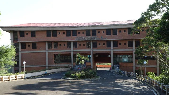
De La Salle Charles University Huang Conference Center
It is located in one of the elevated areas in Calaca namely Sitio Matala in Barangay Cahil. Away from the busy streets, staying here gives the visitors a sense of solitude. This establishment was built to be a place of spirituality and renewal. Students, locals, or tourists who visit this place are expected to experience healing and become closer to God. Training programs, workshops, conferences, or seminars may also be held in this activity center.
Through the generosity and support of Bro. Armin A. Luistro FSC, President of De La Salle Philippines, and Mr. Glennson Vines, Administrator of the Conference Center, this facility has become a Temporary Treatment and Monitoring Facility during the fight against COVID-19. Hence, this establishment has played a vital part in the local government’s response during the pandemic.
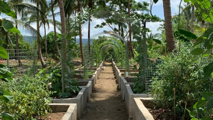
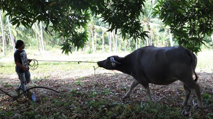
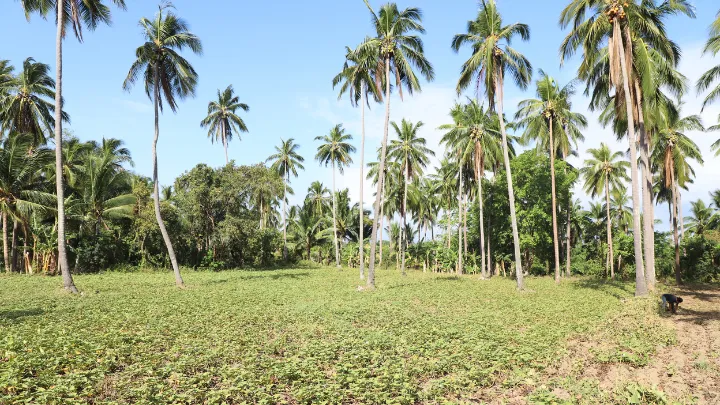
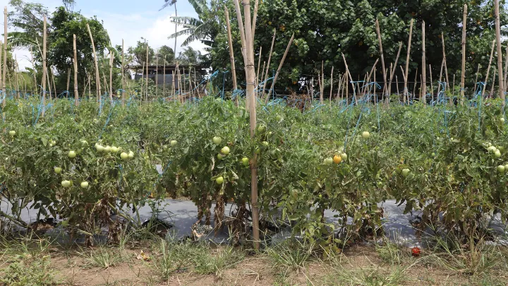
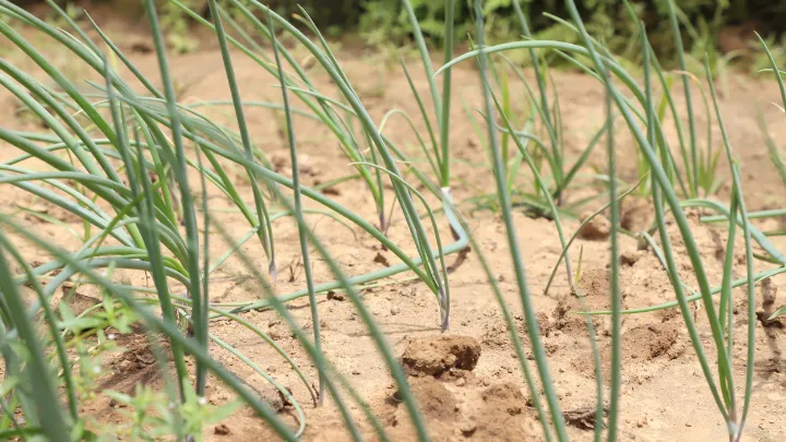
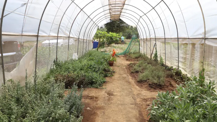
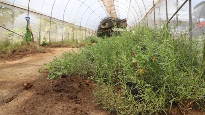
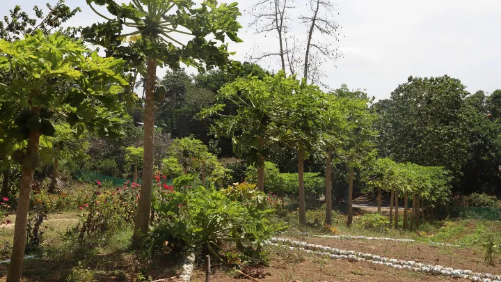
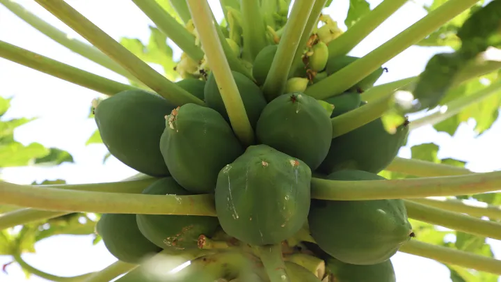
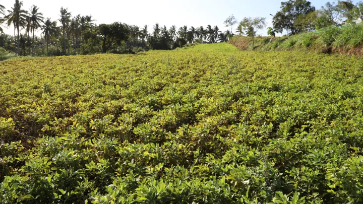
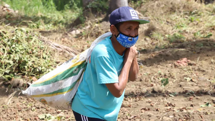
Farms
The total agricultural land of Calaca is 9,868.63 hectares or 87.56% of its total land area. Sugarcanes, rice, and corn are the crops mostly planted within agricultural lands. Through the One Barangay, One Product project, the variety of crops cultivated in Calaca grew in number.
However, these lands do not only serve the purpose of being a source of income among Calacazen farmers, the scenic view it presents is surely something you would not want to miss. These farms will give a scenic drive as you travel around Calaca.


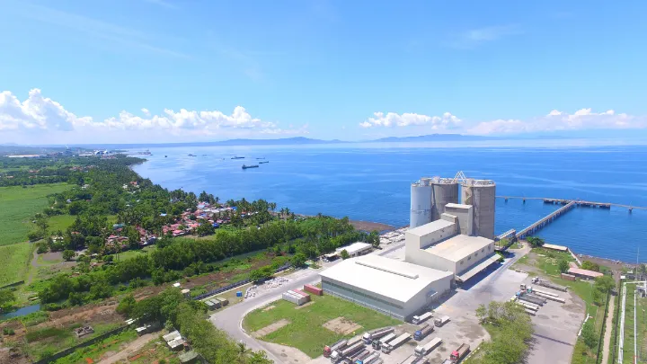
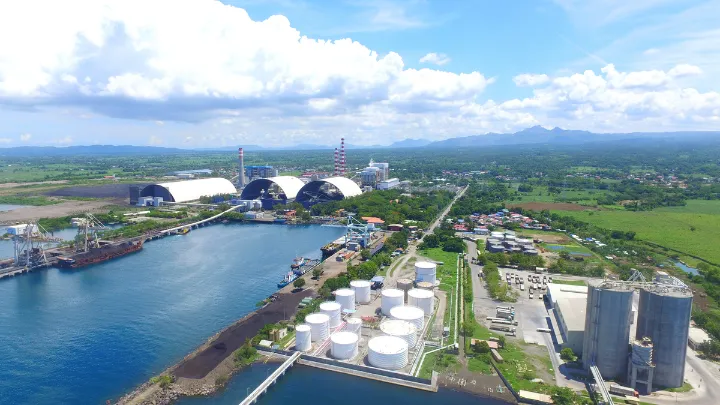
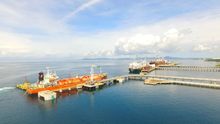
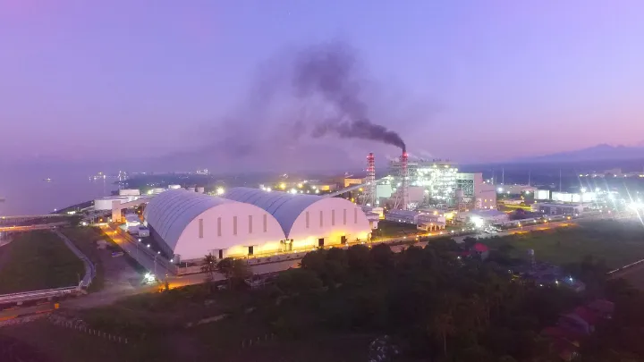
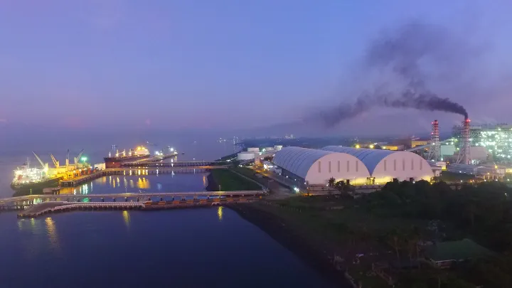
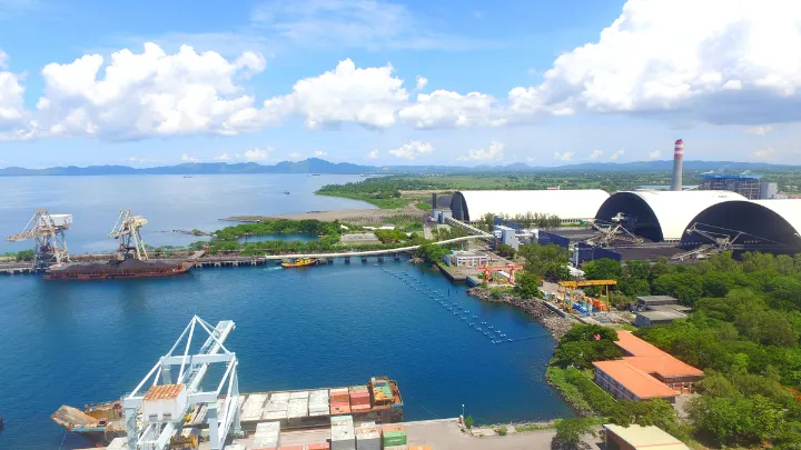
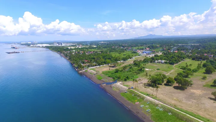
Industrial Buildings and Facilities
Calaca is an industrial haven as it hosts a number of industries such as DMCI Power Corporation in Brgy. San Rafael, South Luzon Thermal Energy Corporation at Brgy. Puting Bato West, and Balayan Distillery Inc. in Brgy. Talisay. It also hosts the Phoenix Petroterminals & Industrial Park Corporation situated at Brgy. Salong, Puting Bato West, and Lumbang Calzada.
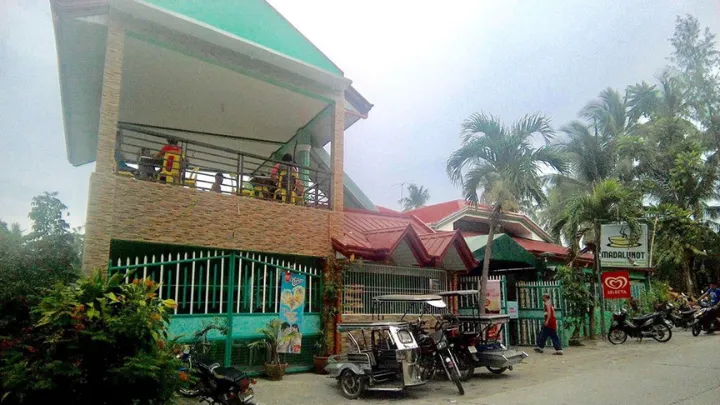
Lomihan sa Madalunot
Lomi is one of the dishes that the province of Batangas is known for. It is a dish with thick yellow noodles served with a gooey soup made from sweet potato starch. You could get a bit more creative with its toppings and choose from chicharon, shanghai, pork liver, or kikiam, fish balls, and squid balls. Onions and boiled eggs are among the choices of toppings too.
Calaca has its own unique version of lomi that tourists and even the locals love. This lomi is from the infamous Lomihan sa Madalunot which makes every visit in Calaca complete and worthwhile.


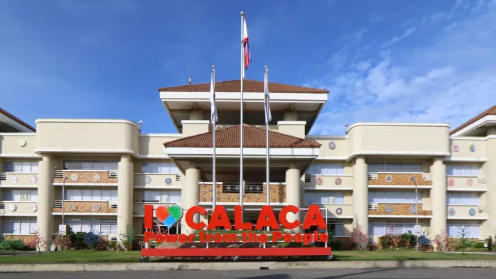
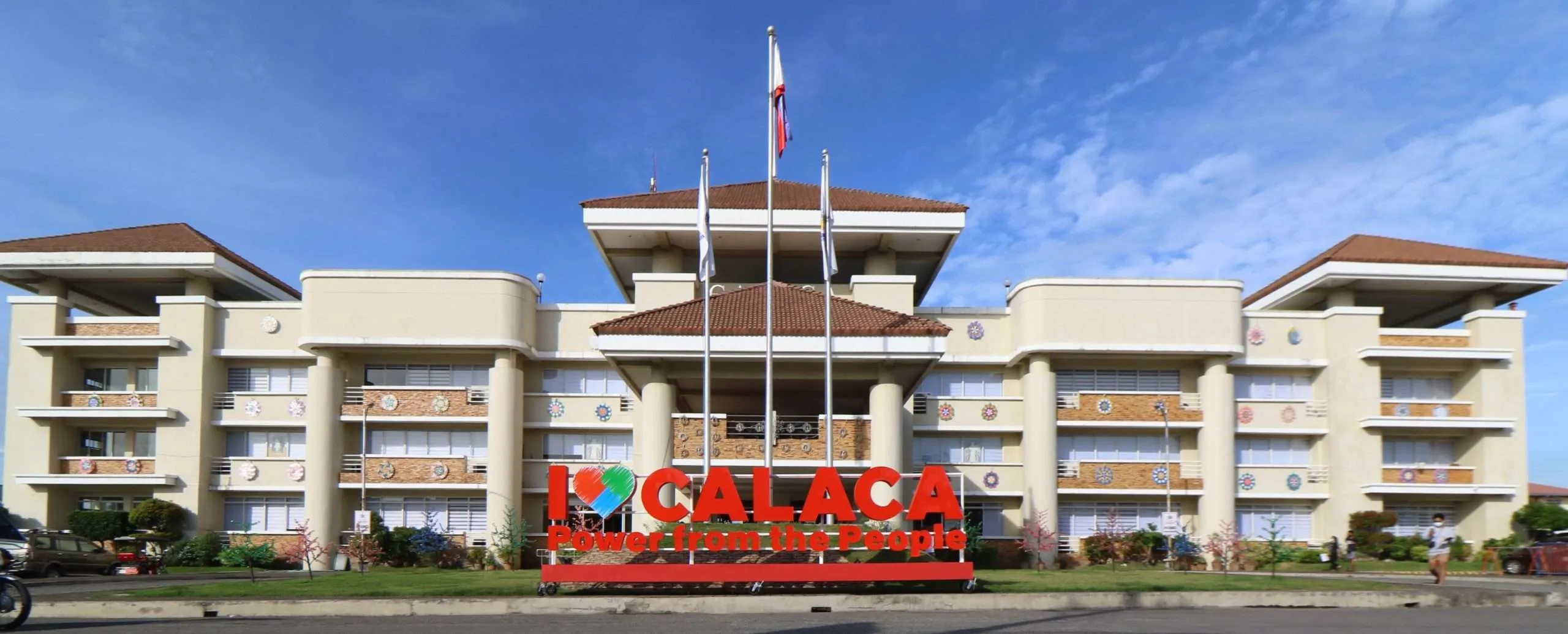
City Hall
The City Hall boasts about the greatness of the system of governance in Calaca as it is a witness to the hard work and dedication of the public servants of the said government unit.
In the year 2006, the construction of the new municipal hall commenced and it was formally opened in 2009. Since then, this establishment has been the home of public service for Calacazens. Its glory is continuously maintained by the repaintings conducted from time to time.
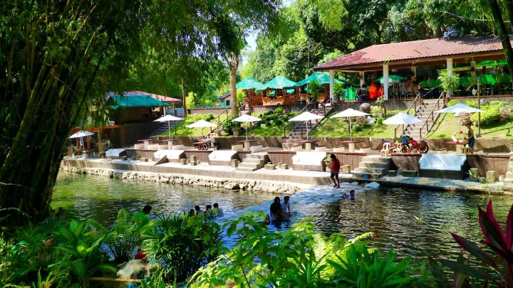
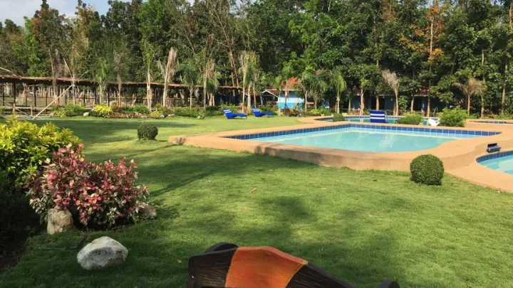
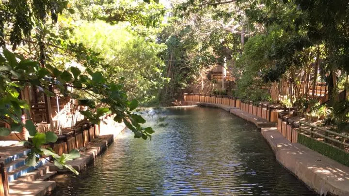
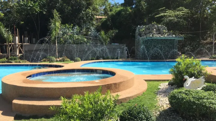
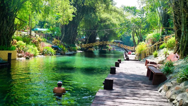
Resorts and Beaches
Beating the summer heat is not a problem for the locals. Calaca has beaches and resorts that have been well-developed over time. Some of these are Yabut Resort in Madalunot, the Aquafarm Beach Resort in Talisay, and the Queen Teresita Beach Resort and Waterpark in Poblacion 6.
Due to the accessibility of these resorts, the residents, as well as tourists from nearby municipalities and provinces, may visit these places any time of the year.
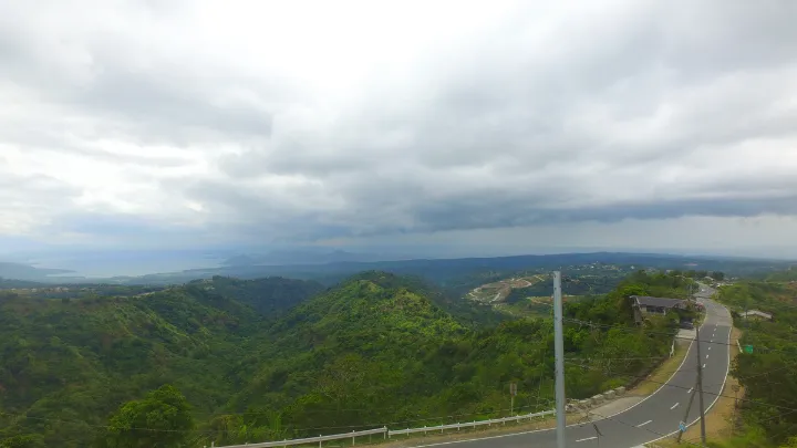
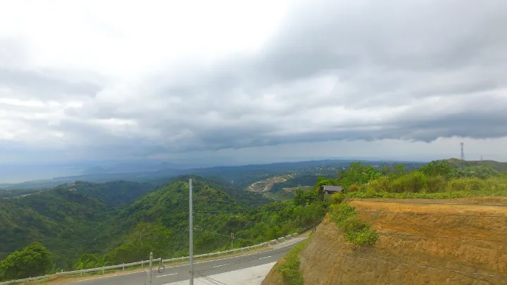
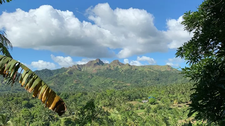
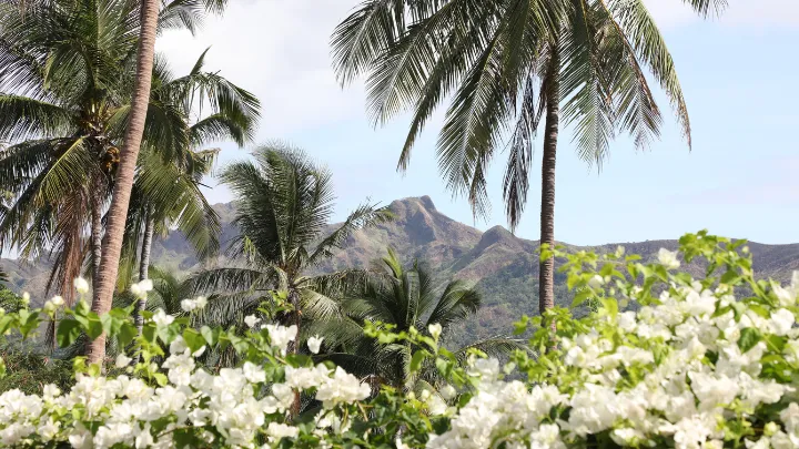
The Majestic Beauty of Taal Volcano
A break from the long ride will surely be worthwhile as the highest points in Calaca give travelers an opportunity to witness the scenic view of Taal Lake and Taal Volcano. With the clear blue sky and milky clouds, the land formation offers striking scenery surrounded by the tranquil waters of Taal lake.
Barangay Tamayo, Bambang, and Bisaya are among the best locations where Taal lake and Taal Volcano could be spotted.
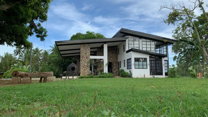
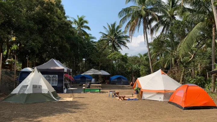
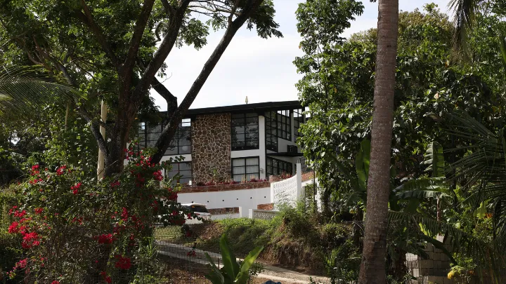
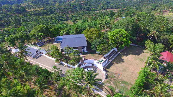
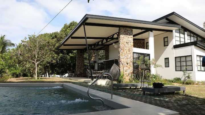
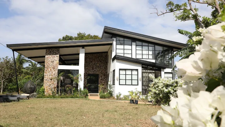
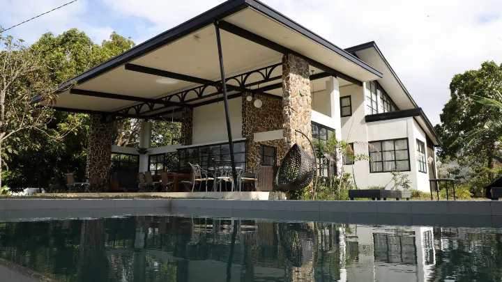
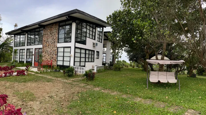
The Pueblo
If you need some time to unwind and relax, then The Pueblo is the perfect place for you! This mountain home is surrounded by luscious greenery and gives you an astonishing view of Balayan Bay as it is also a perfect site to witness the glory of Mt. Batulao.
You could bring your family and friends and spend days in the mid-century home which was designed to make you feel that you are one with nature. You may enjoy other amenities such as the infinity pool, a camping site, trampoline, grill, and their plantation where you may harvest from.